
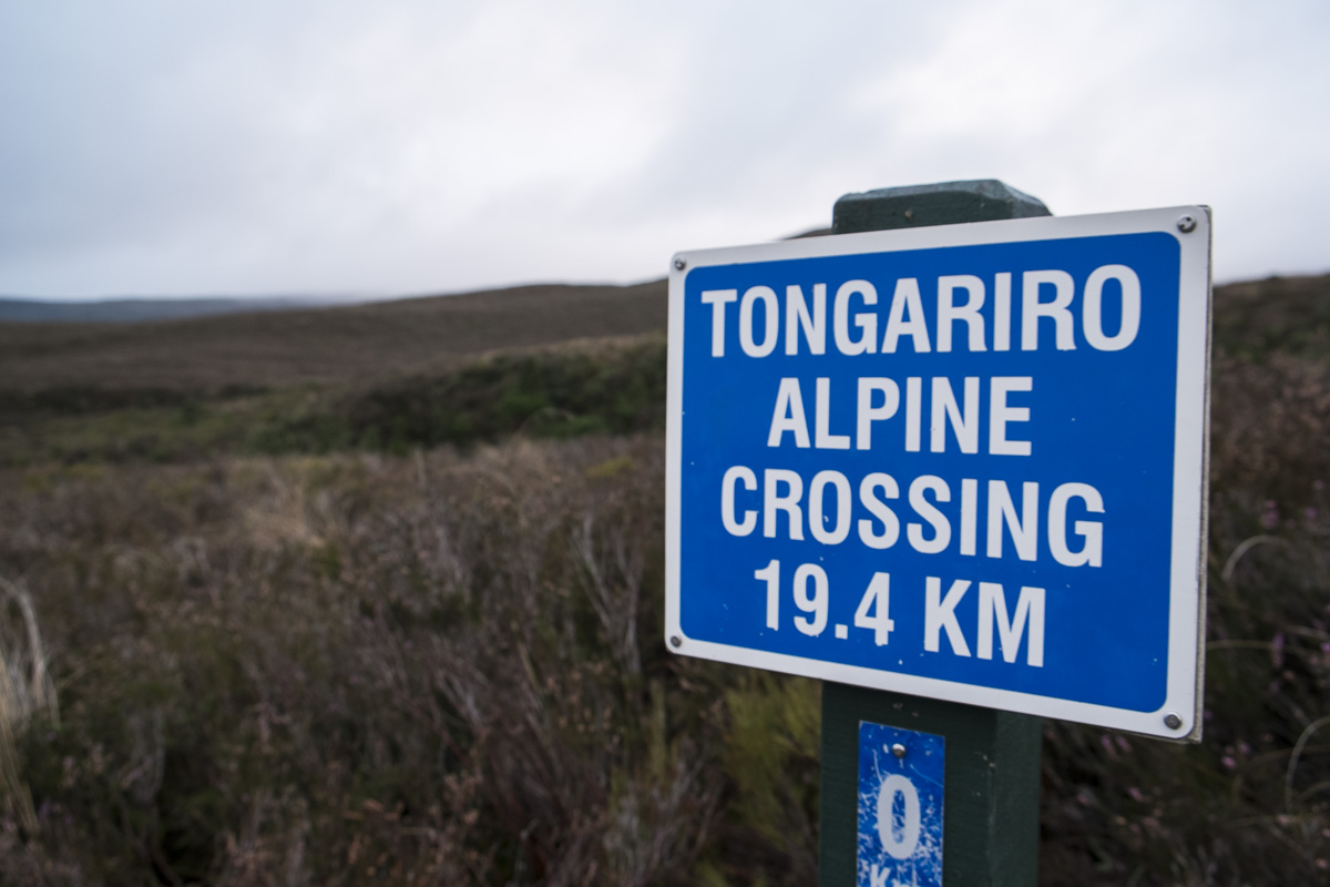
Our main aim of visiting Taupo was to do the Tongariro Crossing. It’s one of New Zealand’s most famous one day hikes and as it also takes you right past the volcano that played Mount Doom in the Lord of the Rings movies it is also one of the most popular. Taupo is the nearest large town and a good base for taking on the challenge – most of the accommodation options should be able to hook you up with return travel to the crossing. You get picked up at about 5am, dropped off around 6am, collected from the other end of the crossing around 2.30/3pm, and charged $60 NZD (£30) for the privilege.

Safety note: Although this is a popular hike, it’s still a very serious one. You cross 3 active volcanoes, clamber up and down rocky slopes and the weather can change in an instant. If you are planning on doing this be sure to wrap up in plenty of layers, don’t forget hats and gloves, and you definitely need decent footwear. Casual trainers won’t hack it. Go for hiking trainers or rent a pair of hiking boots from your driver guys before you start – no-one wants to break an ankle 6 miles from the nearest hint of civilisation! Also be sure to pack enough food and water for the duration. We brought 3 litres each and got through most of it on the way.
Back to our tale: We were picked up from our hostel while it was still dark, the drive to the start of the crossing takes nearly an hour so it’s well worth grabbing an extra kip once you are moving. The transport guys will get you to sign in and give them some details to ensure no-one gets left behind but once you get to the trail you are given a map and left to it. Just like everything else in New Zealand you are pretty well guided throughout the trail with handy direction signs and distance markers to keep morale high.
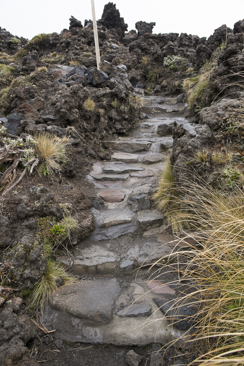
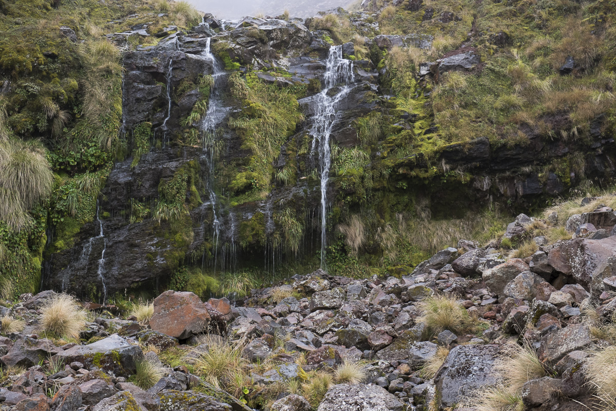
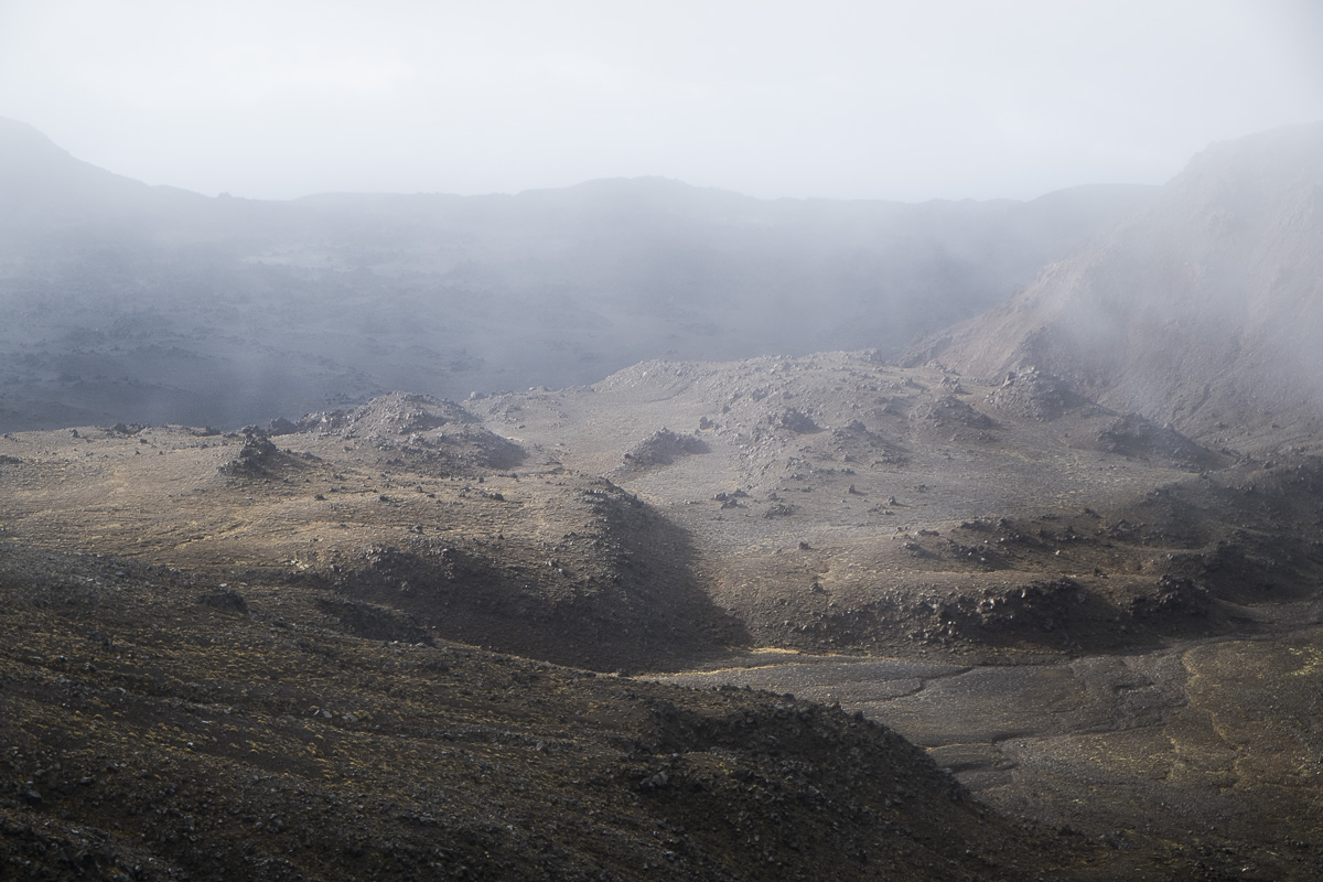
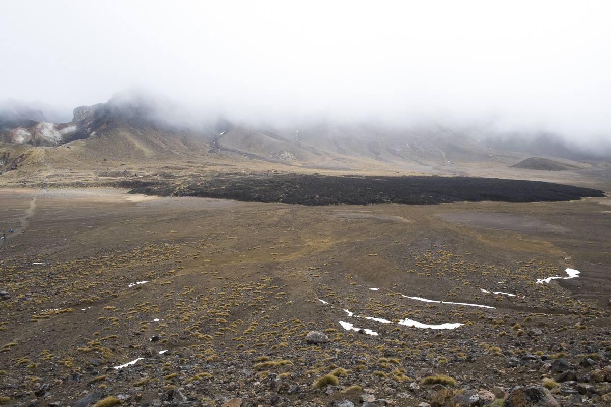
The first part is a fairly straight path up a creek and across an amazing lava field. You can see where the flowing lava has been frozen into place and can only imagine as to how destructive it was when it was freshly erupted. Eventually you reach the first milestone, the Soda Springs. This area contains the last real toilets you’ll see in a while. There’s also a cool little detour to see a nearby waterfall up close. A little after the Soda Springs you hit the first real challenge, the Devil’s Staircase! This is a winding path of steep, high, rocky stairs that will test your thighs to their limits. Looking back it’s one of the hardest bits of the route so at least you can get it out the way early. Towards the top there’s also some big-ass rocks that are a good place to have a rest and bite to eat (keep that blood sugar up!).
Once you reach the top of the devil’s staircase things flatten out again. I would imagine that the views up here are quite something, but unfortunately we were in the middle of some grim, cloudy weather and could only see about 100m around ourselves at best. This flat area, known as the South Crater is where you pass Mount Ngauruhoe (AKA Mount Doom). You can make the tough optional climb to the top at this point, however we were warned that if the top wasn’t visible due to the weather then it really shouldn’t be attempted, and the clouds were such we could barely tell there was a mountain there at all! Unfortunately conquering Mount Doom would have to wait until the sequel!
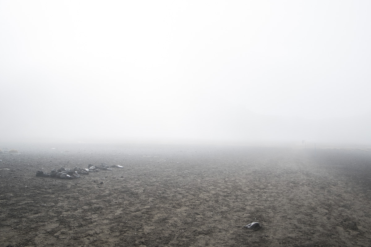
The flat crater bottom was like nothing I’d ever seen – with the closing fog and desolate red landscape it felt like we were walking on Mars! The respite from climbing didn’t last too long though and soon we were ascending another ridge again. This ended up being the toughest part of the climb and wasn’t helped by the fact it started snowing! So much for a nice day! We powered onwards with all our layers fully zipped up and eventually the weather passed. We had made it to the highest point of the hike at this point, although there was another optional side trek to reach the summit of Mount Tongariro which is even higher. Given the weather didn’t look like clearing up, which would have spoiled any potential awesome views, we decided to pass on this and continue onwards.
We headed towards the Red Crater and were amazed to see steam rising from the soil on a ridge. At a touch the ground was warm! Although the air was freezing the magma below the surface made the soil comfortably warm. We were freezing so took it as a great opportunity to sit down for a drink and snack. Unfortunately the warmth was bittersweet as the steam rising up meant we ended up pretty damp as well, making getting up seem even less fun! But there was only one way down from the mountain so we ploughed on around the Red Crater. Unlike the flat open South Crater, the trail skirts around the Red Crater’s edge and it’s a pretty steep drop off down the side. The whole landscape is just as stunning and alien as before though.

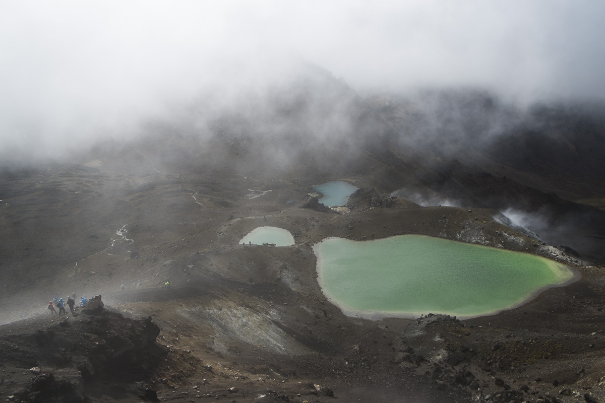
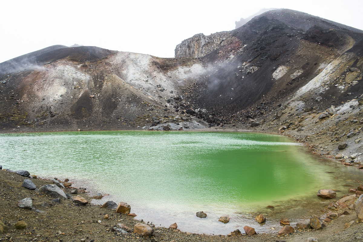
A little further around and we reached the highlight of the walk, the Emerald Lakes. Three pools of water that are a vibrant green in colour but as pretty as the look they would kill you if you went swimming. The green colour comes from the dissolved minerals that make the water very acidic with a pH ranging from 3-5. This was prime photo time for me and luckily the weather cleared up just a little to make my pictures a bit more satisfactory.
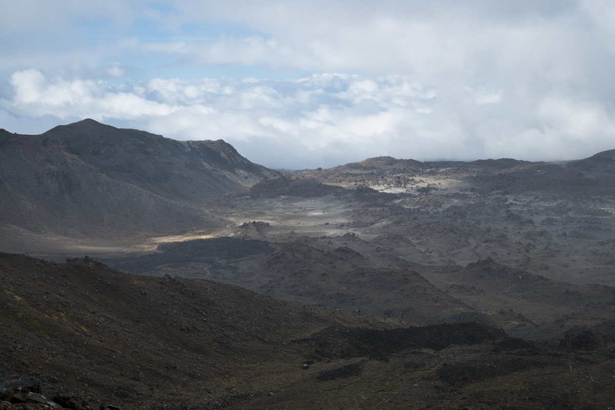
After a brief refuel by the emerald lakes, the going eased off quite a bit across another flat area, the Central Crater. Again we were walking past frozen lava flows from previous eruptions and marvelling at the scenery. There was another small climb at the other side of the crater to reach the Blue Lake. Not quite as startling or acidic at its emerald brothers, Blue Lake is another mineral lake with a pH around 5. Still not one for drinking, but very pretty all the same.
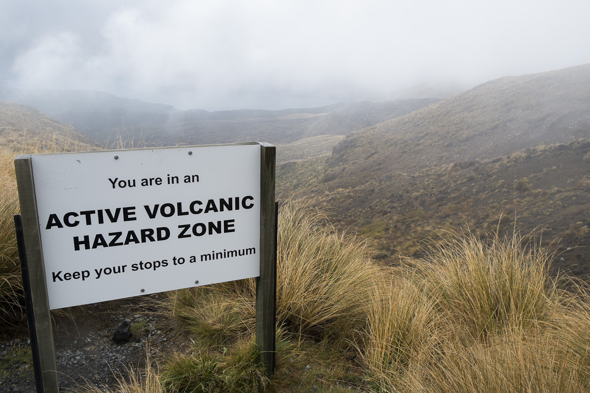
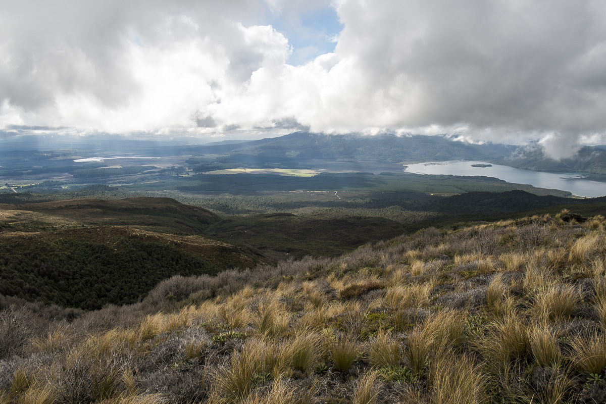
Once the Blue Lake is behind you its mostly downhill back towards the car park. That’s not to say that it isn’t still a long way down or the scenery isn’t pretty. There are spectacular views across the landscape towards lakes and mountains. And to top it all off the weather took a big turn for the better and we had to strip off all our warm layers to enjoy the sun. Coming down the mountain things get much greener as you move through scrub and grassland towards the Ketetahi Hut, rudimentary accommodation where you can finally find a real toilet once again. It’s a good place for a final drink/scran before the final leg of the journey but you also pass this brilliant sign just before you get there which makes things a little more tense!
The trail winds down the hills away from the hut, down towards the valley floor. Eventually you hit a tree line and the last couple of miles are a pleasant walk through the woods towards the car park. As hard as some of the earlier climbs were this last stretch seemed to last forever! The final mile felt as long as the first four combined! We finally reached the finish somewhere in the middle of our group of people, lay down on the grass and awaited our coach home to take us to a well-deserved hot shower, nap and steak dinner!
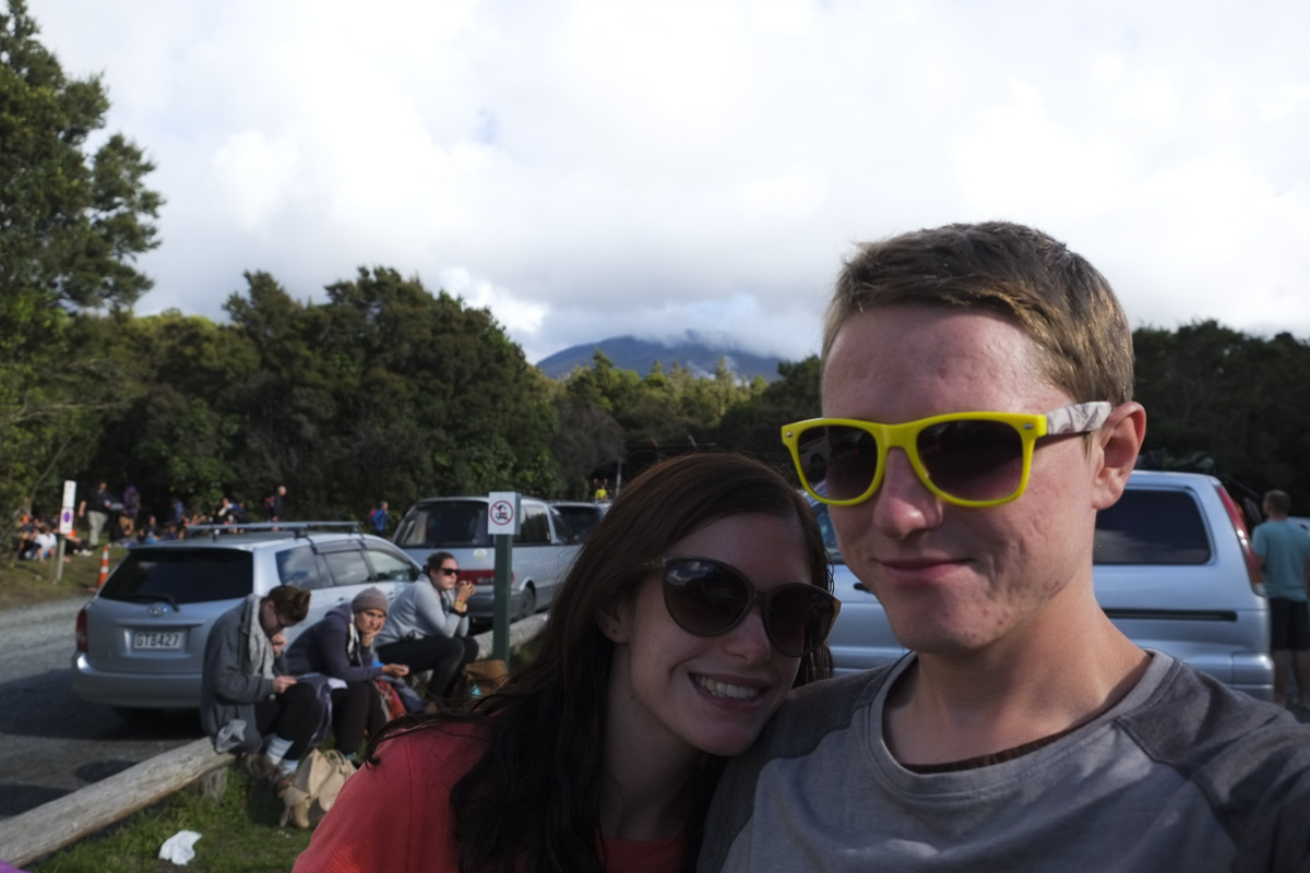
We made it!